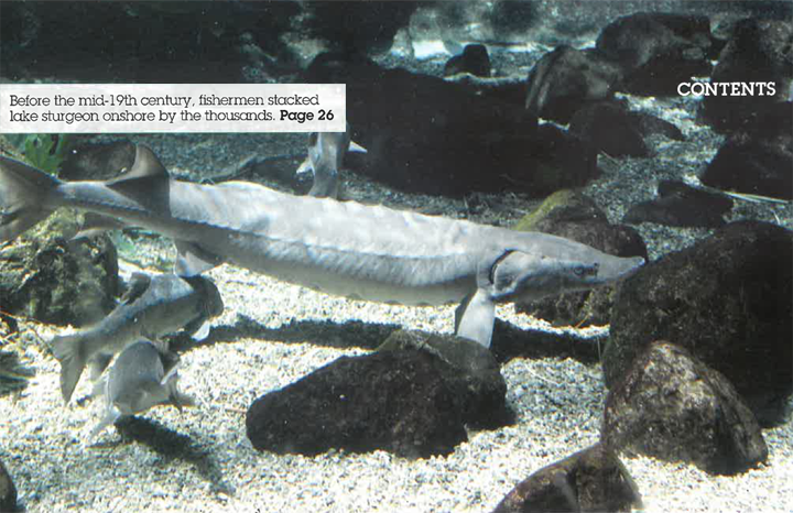
Friend or foe?
Negotiating with former adversaries comes with a unique set of challenges.
by Julee Boan
In the early 1970s, a popular bumper sticker read: “If you are cold, hungry and out of work, eat an environmentalist.” At the time, and for many years after, an “us versus them” mentality dominated the discourse between tree huggers and corporate interests. The environmental community relied on a predictable bag of tricks to express opposition to destruction of habitat and wildlife that nearly always included a blockade along a logging road when forests were in jeopardy.
This approach proved to be a double-edged sword. On the one hand, it could be quite effective. The blockades in Clayoquot Sound during the 1990s saved significant old-growth rainforest in British Columbia. On the other hand, environmentalists were accused – not without some justification – of paying little or no attention to the subsequent spike in the unemployment rate when big operations or projects were cancelled. Even in cases where environmental safeguards have had no economic impact, environmental groups routinely are considered responsible for industry’s economic struggles. The result has been the false dichotomy of jobs versus the environment that unjustly forces communities to make tough choices.
As the historic Canadian Boreal Forest Agreement (CBFA) demonstrates, however, times are changing. Today, the new face of environmentalism has us rolling up our sleeves with industry, to figure out if and how we can have our cake and eat it too. In that agreement, nine environmental groups and 21 member companies of the Forest Products Association of Canada (FPAC) negotiated a ceasefire that will result in careful planning for 72 million hectares of boreal forest licensed to FPAC members. Moreover, through the agreement, members of FPAC are committed to high forest management standards in logged areas, while conservation organizations are committed to publicly recognizing and supporting the forest industry’s efforts.
After the agreement was signed, national organizations approached provincial environmental groups to assist in the implementation of the CBFA goals. Ontario Nature is one of the provincial organizations engaged in this challenging process, an undertaking that is not without its critics.
The fact is that, in northern Ontario, responses to the CBFA range from cautious hope and interest to fear, even anger. The concern is that big interests (environmental and industrial) mostly based in the south are making decisions that will affect northern residents without our involvement. Once again, the criticisms merit a hearing. When environmental groups partner up with former adversaries, do we risk losing meaningful connections with local concerns and grassroots support?
Some environmental groups are also skeptical of the process, arguing that the CBFA simply makes the consumption of wood products more palatable. The process appears to promote consumerism rather than straight-up forest conservation.
There are no easy answers. Nevertheless, while mounting blockades and waging “Do Not Buy” campaigns may create much-needed space for improved dialogue on forest values, they cannot deliver solutions. On the contrary, threatened woodland caribou that depend on the boreal forest have undergone population declines for decades – they are the harbinger indicating that forest management is falling short of our societal goals. An agreement like the CBFA provides market-based incentives for better forestry practices, an option well worth pursuing when direct opposition to logging has, in many respects, been insufficient.
In addition, the boreal ecosystem spans 750,000 square kilometres, an area so vast it can absorb some development. Rather than issue a blanket demand that logging stop, we can think in terms of thresholds – research indicates that caribou will persist where habitat disturbance affects less than one-third of their range.
Ontario Nature and other conservation groups know that we need agreement from First Nations communities – who have constitutionally protected Aboriginal and treaty rights – for any initiatives that involve changes to the landscape to be successful. We are already talking to several First Nations and listening to their priorities for lands and waters.
Here’s what Ontario Nature hopes to achieve: fully functioning boreal ecosystems that support strong and healthy communities. Already the CBFA can boast some significant achievements: industry has agreed to stop logging caribou habitat in portions of the southern boreal forest at least until 2013, creating opportunities for new approaches to forestry.
These types of negotiations – involving more than a dozen groups in Ontario – are neither quick nor straightforward. But we believe that with patience, persistence and goodwill, the goals set out in the CBFA can be achieved.
Julee Boan is Ontario Nature’s boreal program manager. She lives in Thunder Bay.
The problem with aggregates
by Caroline Schultz
A strong wind whipped in heavy grey clouds, and the threat of rain was imminent as several hundred shivering people queued up at the edge of a woodlot north of Shelburne at the beginning of a unique demonstration of civil society. They were lining up to protest against the proposed “mega-quarry” in North Dufferin County’s Melancthon Township and to raise funds to fight the application and to celebrate the area’s farmland and the food it produces. Eight hours and 28,000 people later, world-renowned chef and president of the Canadian Chefs’ Congress Michael Stadtländer had pulled off the coup he had planned: Foodstock, with 100 top chefs from across Ontario and beyond and an army of local volunteers.
Like most who attended Foodstock, I drove two and a half hours on roads and highways made of the very stuff that was the reason for this protest journey of thousands of Ontarians. The proposed quarry, which would be North America’s second largest, is the most recent in a long history of pits and quarries that have stirred public outrage. But this project is astounding in the way that the land was acquired from farmers and its sheer size and scale. The quarry would spread across 2,135 acres (937 hectares) and be almost 80 metres deep in places, bringing with it the spectre of major loss of some of Ontario’s best farmland, threats to ground and surface waters, and loss of wildlife habitat and other natural heritage.
Irish rock band U2’s 1987 song “With or Without You” could be the theme song for society’s relationship with the aggregate industry. As long as the population in this province continues to grow, we will need to feed it with the raw material for constructing roads, buildings and other infrastructure. Apparently, we can neither live without stone, sand and gravel nor live with the way these materials are produced. Or could we?
In his article on page 32, Ray Ford describes a new bend in the road of aggregate production in Ontario – a collaborative initiative of six environmental organizations and six leading aggregate industry players, including representatives from some of its heaviest hitters, to tackle the major sources of conflict between the environment and communities on one hand and the producers on the other. The Ontario
Aggregate Forum’s flagship initiative, a voluntary certification program based on rigorous environmental and community standards, has the potential to be a game changer, raising the performance bar well above the level required by regulation through creative and collaborative problem-solving and innovation.
Ontario Nature is a founding member of the Aggregate Forum. Over many years, we have fought the granting of specific aggregate extraction licences and worked to change legislation to protect natural heritage from the impact of pits and quarries. Now we are looking for something different. With more than 3,000 pits and quarries currently licensed in Ontario and many more in the pipeline, we need systemic change rather than fighting one-on-one battles. Sitting down with this industry to figure out how to make it “green” has been an interesting challenge but is an investment that may in the end reap great rewards. There will always be a need for occasional David and Goliath battles, such as the one in Melancthon Township, but we hope these will become increasingly rare – not because environmentalists and communities are depleted and defeated but because we have found a better way to protect our communities and environment.
Carbon credit swap
by Allan Britnell
Most of us have known for years that trees are good for the environment, particularly because of their ability to sequester greenhouse gases spewed by cars and the other conveniences of our lives. Yet, until recently, no one knew precisely just how much carbon forests could store. But a detailed analysis published in the August 19, 2011, issue of the journal Science has cleared the air on how significant a factor forest-carbon capture is. Read the full article…
Follow the leader
by Joshua Wise
This summer, the Kitchenuhmaykoosib Inninuwug (KI) First Nation took a bold stance to protect the Big Trout Lake watershed by ratifying a watershed declaration and consultation protocol aimed at preserving 1.3 million hectares of boreal lakes, rivers, forests and wetlands that form the spiritual, as well as physical, centre of the community. Read the full article…
Climate change economics
by Peter Rosenbluth
Many in the environmental community found that the recent provincial election was as notable for what was not discussed as it was for the points of contention. Absent from most debates was any discussion of conservation in an era of climate change. While candidates crossed swords over, for example, the applicability of the HST to the price of gasoline, no one considered the near future impacts of global warming on the enormous, yet fragile, northern ecosystems. Read the full article…
Beetle mania
by Peter Gorrie
After nearly a decade of destruction due to a voracious, invasive insect, a glimmer of hope is stealing into Ontario’s gloomy ash forests.
The emerald ash borer has already destroyed most of its host trees in southwestern Ontario, specifically Essex County where this creature entered the province nine years ago. On its own, and with help from humans moving firewood and other wood products, the brilliantly coloured beetle has expanded its range eastward past Toronto. Read the full article…
In search of creepy crawlers
by James Paterson
From Toronto to Thunder Bay, Ontario Nature staff have been travelling across the province in search of snakes, salamanders and other creeping, crawling and slithering wildlife. As part of the Ontario Reptile and Amphibian Atlas project, conservation staff have conducted workshops, presentations and field surveys to increase awareness of and gather data about this unique group of creatures. The goal is to learn more about where reptiles and amphibians can be found and their population sizes, largely through observations that members of the public submit. Read the full article…
The high road
In a groundbreaking alliance, the aggregate sector and conservation groups, led by Ontario Nature, make common cause on a green certification standard for gravel.
By Ray Ford
It has been a decades-long cold war, with some very hot engagements. But the struggle between Ontario’s $1.3-billion sand, gravel and stone industry and the people seeking to safeguard the province’s landscape, could, at last, be reaching a detente.
That may be tough to believe for residents of Dufferin County, where the application for a mammoth 937-hectare Melancthon Township quarry in the heart of Ontario’s potato-growing country (see “The big pit,” Autumn 2011) seems to indicate the conflict is scaling up. The bid elicited more than 2,000 objections, sparking marches and a tractor convoy, and inspiring Foodstock, a culinary demonstration sponsored by the Canadian Chefs’ Congress. This sort of opposition is not cheap, especially when donations come in $20 and $50 at a time. But North Dufferin Agricultural and Community Taskforce vice-chair Carl Cosack promises that if the quarry’s backers “are willing to go down to the wire, we’ll meet them, step for step.”
Yet even as new battles brew in parts of the province, potential for a new accord exists between industry and environmental groups – one that could result in gravel being extracted in a greener, more sustainable way without generating the kind of confrontation inherent in the present system. Taking the lead in the effort is the Ontario Aggregate Forum, founded by members of both camps in 2008. “We’re looking for a more systemic way of lessening the impact of aggregate extraction,” says Caroline Schultz, executive director of Ontario Nature and the organization’s representative on the forum.
The forum hopes to have the basic outlines of a plan for greener aggregate extraction next year and has already hired consultants from Deloitte to scan the world for leading standards and practices. For Bob Patrick, president of the Coalition on the Niagara Escarpment (CONE) and the coalition’s representative to the forum, the process could yield third-party environmental certification similar to that in place for lumber, paper, coffee and seafood.
If petroleum is the lifeblood of modern society, aggregates – including sand, gravel, stone, earth, clay and shale – form the bones. In 2009, the last year for which complete figures are available, Ontario’s pits and quarries produced 153 million tonnes of aggregates (almost 12 tonnes per person) for use in everything from roads, bridges and sewers to buildings and foundations, glass, paint, paper, fertilizers, even pharmaceuticals.
These resources take a heavy toll on the environment. Even with a sensitive rehabilitation after a pit or quarry has been played out, extraction is a permanent eviction for the plants and animals originally on the site. Then there are the problems with dust, noise, lighting and truck traffic, potential changes to the filtering and storage of groundwater, and carbon emissions. Every kilometre a gravel truck travels adds about 1.5 kilograms of greenhouse gases to the already burdened atmosphere.
“If you look at all the stresses on the landscape, aggregate extraction is significant,” says Schultz. “It all boils down to growth and urban sprawl, where we build and where roads are needed. Growth is the monster that needs to be fed.”
Where the aggregates go
The amount of aggregate used in various construction applications:
- kilometre of a two-lane highway: 18,000 tonnes
- 2,000-square-foot house: 250 tonnes
- kilometre of a subway line: 114,000 tonnes
- kilometre of water main: 1,000 to 4,500 tonnes
(Source: State of the Aggregate Resource in Ontario Study, 2010)
The fact that industry and environmentalists have come together to tackle these issues is a near miracle, considering that the two sides have spent decades, as Ron Reid of the Couchiching Conservancy says, “tossing bricks over the wall at each other.” Members of the forum are familiar with the sort of bitter, protracted and expensive dispute now taking place in Melancthon. When CONE and Halton-based Protecting Our Water and Environmental Resources (POWER) teamed up to fight the 2004 expansion of Dufferin Aggregates’ Milton quarry, the $175,000 bill “basically bankrupted us,” Patrick says. Hobbled by debt and without the cash to maintain fulltime employees, “we’ve been limping along ever since.”
Industry has deeper pockets, but also larger bills. “We have to buy land on speculation and hope we can get approval” to mine it, says Ken Lucyshyn, another forum member and vice-president of aggregates and construction for Walker Industries, based in Thorold. His firm has spent more than $10 million on a quarry application in Duntroon and, after six years, has yet to receive a go-ahead. A delay of that length is not unusual for large and contested proposals that, like the Duntroon application, are appealed to the Ontario Municipal Board (OMB), the province’s land-use adjudicator. “When you go through a months-long OMB hearing and spend millions,” says Moreen Miller, president of the Ontario Stone, Sand & Gravel Association, “to me that’s a colossal waste of energy, money and time.”
Where the aggregates are
The Greater Toronto Area uses about one-third of Ontario’s aggregate, so it’s no surprise the province’s top aggregate-producing municipalities are mostly clustered in southern Ontario. Although Ottawa is the number one municipal producer, other top 10 producers are Hamilton, Kawartha Lakes, Clarington in Durham region, Milton and Caledon.
While areas with the highest populations tend to demand the most aggregate, they also face a wide range of competing priorities, including natural heritage protection, agriculture and the concerns of local residents. The Ministry of Natural Resources 2010 State of the Aggregate Resource in Ontario Study notes that land-use plans for the Niagara Escarpment and the Oak Ridges Moraine either outlaw or restrict the expansion of pits and quarries across significant swaths of those areas, even though each contains high-value aggregates. For aggregate producers and users, then, the challenge lies in finding suitable rock while limiting the environmental impact of its extraction. Given the difficulty in getting approval for new sites, the report notes, “the majority of the reserves supplying the GTA market are coming either from moderate or scarce reserves.”
Ray Ford
Here be giants
First overfishing, then hydro dams. Lake sturgeon, Ontario’s largest and longest-lived fish, now belongs to one of the most beleaguered groups of animals on the planet.
By Peter Christie
Tim Haxton shifts his chair to allow his visitor a better view of the photograph on the computer screen. The dark image of a fossilized fish makes a subtle “S” in the lighter brown mud-stone that surrounds the shape. It is as if the creature suddenly turned to stone during a lazy swim through murky water. The petrified details – even the fine rays of fins – are crystal clear, and the identity of the fish is unmistakeable. “Sturgeon,” confirms Haxton, a fisheries specialist with the Ontario Ministry of Natural Resources (MNR). “This one is probably about 200 million years old, from the Jurassic period. They really haven’t changed much in form or function since.”
The soft-spoken biologist has collected hundreds of photos during his 15 years of studying lake sturgeon, Ontario’s largest and longest-lived fish. His picture of the fossil, however, adds an almost mind-boggling historical view to our discussion of sturgeon conservation: close ancestors of this formerly indomitable animal were swimming the world’s waters before the Atlantic Ocean was born, before birds flew and about 200,000 millennia before humans first appeared. They swam right through the great extinction of the dinosaurs and, despite volcanic eruptions, ice ages and other climatic calamities, have overcome every threat they encountered – until now.
Sturgeon today confront a higher risk of extinction than any other non-insect animal in the world, says Haxton, citing the conclusions of a 2010 workshop of the International Union for Conservation of Nature (IUCN). Decimated by periods of overfishing and prized for their eggs, which are sold as expensive caviar, many sturgeon populations around the globe have been in free fall for decades. All 27 sturgeon species – including lake sturgeon – are on the IUCN’s Red List of Threatened Species. Two-thirds of these are considered “critically endangered” because their plummeting numbers or shrinking, fragmented ranges mean that the odds of this fish disappearing for good are “extremely high.” Four sturgeon species may already be gone forever.
Which is why, Haxton says, conservation of Ontario’s lake sturgeon is so crucial. These fish are better off than many sturgeon species but have troubles of their own. In 2009, two of the three populations of lake sturgeon – the only type of sturgeon found in Ontario – were listed as threatened on the province’s Species at Risk roster. The other, most northerly population is considered of special concern. In the Great Lakes in particular, stocks of this now rarely seen fish never recuperated after an overzealous fishery a century ago reduced their numbers to a fraction of their former population. Meanwhile, human interference seems to be hampering their recovery. The worst culprits are hydro dams, whose number is expected to surge as the province pushes for more renewable energy (see “Waterpower,” facing page).
All this only makes Haxton’s main point more significant: the lake sturgeon that live in at least 128 lakes and reservoirs and 101 rivers across Ontario (as well as sturgeon in parts of Quebec and Manitoba) represent “the last, good remaining stock of pristine sturgeon anywhere in the world.” They are, in other words, possibly the final hope for one of the oldest and most beleaguered groups of animals on the planet.
“That’s what I’m trying to get across,” he says. “We have one of the few bastions left.”
Waterpower
For the Ontario Rivers Alliance, lake sturgeon is something of a poster fish. The coalition of local and environmental groups was formed in early 2011 to warn people about changes to Ontario’s rivers, whose health is threatened by scores of proposed new hydroelectric projects. The potential impact of dams on sturgeon is just one of the group’s concerns, but the fish symbolize other worries, such as strangled, unnatural river flows and murky, mercury-infused water. “This is like a green energy rush,” laments Linda Heron, chairperson of the alliance. “We’re hurtling forward without really thinking this through at all.”
Heron is referring to the Ontario government’s 2009 Green Energy Act and the guaranteed pricing for renewable power (the feed-in-tariff, or FIT, program) it introduced. The program made hydro development economically viable on rivers where these projects would have been unthinkable in the past. Since September 2011, 102 new hydro projects have applied for approval by the Ontario Power Authority (OPA), which administers the FIT program. Although none of these projects have been built so far, as of September the OPA had given a go-ahead to 49 projects. The new ventures would mean that, within a few short years, the province will have significantly more than the approximately 200 waterpower facilities currently operating, which supply about a quarter of Ontario’s power.
The industry argues that any environmental harm to the rivers will be minimal. “We are confident that Ontario’s very rigorous class environmental assessment will ensure any impacts from dams or other aspects of these projects will be carefully considered and minimized,” says Colin Hoag, a policy advisor with the Ontario Waterpower Association, an industry organization representing hydro companies. The alliance is not convinced. The group – which includes such organizations as Algonquin Eco Watch, Friends of Temagami, the French River Stewardship, the Canadian Parks and Wilderness Society (Ottawa Valley), Whitewater Ontario and almost a dozen others, along with many individuals – is concerned that the political push for renewable energy is putting pressure on the Ministry of Natural Resources and the Ministry of the Environment to overlook their responsibility to safeguard the integrity of Ontario rivers. “Rather than protectors of our environment, these ministries have become more like facilitators for industry,” argues Heron.
This fall, the Ontario Rivers Alliance challenged the first environmental assessment (EA) completed for a FIT hydroelectric project – a generating station proposed for the Ivanhoe River about 100 kilometres west of Timmins. They have launched another challenge to a similar project on the Serpent River and a third is in the works. The group says the environmental safeguards for waterpower projects under the “class” EA guidelines tailored for the hydro industry are not demanding enough. It’s asking the government to require an independent (non-industry) EA that considers what the alliance hopes will be a wider range of potential environmental impacts.
Hoag disagrees, arguing that the class EA provides ample protection for Ontario’s rivers. “We have a great assessment process,” he says. “Compared to a lot of other jurisdictions, Ontario is very progressive.” Ultimately, the Ontario Rivers Alliance wants the government to seriously consider the conundrum that being progressive about greenhouse gas emissions could mean other environmental concerns drift downriver without a paddle.
Peter Christie
If lake sturgeon are a living link to our primeval past, they certainly look the part. Lead grey or deep, primordial brown, adult sturgeon appear to belong to another time. Their skin is without scales and leathery, and their fins set back toward their sickle-like tail. Mature sturgeon are huge, frequently a metre or more long. Some are giants, reaching a length of four and a half metres and weighing up to 185 kilograms (the weight of a small piano). Despite their size, lake sturgeon inhabit the relative shallows (between five and 10 metres deep) where they patiently scour the bottom, using four sensory barbels hanging near their noses to locate insect larvae, snails, crayfish, clams and sometimes small fish. Like sharks and other ancient fish, sturgeon have a skeleton of cartilage instead of bone and move with an almost fluid gracefulness. Also like sharks, these prehistoric fish have a long snout, and their eyes are eerily black.
“The first European settlers hated them,” says John Casselman, an adjunct professor at Queen’s University and a former senior scientist at MNR’s Glenora Fisheries Station near Picton. Before the mid-19th century, vast numbers of sturgeon swam in the clear water of the Great Lakes and its undammed tributaries, and were despised for fouling nets and gear set for trout and other, more useful species. (The settlers’ view of sturgeon was in sharp contrast to the centuries-old beliefs of many Ontario First Nations people, who revered it as a source of food, oil and leather, and celebrated it in rituals and legends.) Fishermen stacked “nuisance” sturgeon onshore by the thousands and left them to dry, later to be used as furnace fuel for steamships.
The Couchiching Conservancy
“We did not inherit this land from our fathers. We are borrowing it from our children.”
In southern Ontario, we have borrowed heavily from our children. The story is well known, if not well heeded: urban sprawl has paved over large tracts of green spaces at an alarming rate.
The Couchiching Conservancy has met this challenge head on by managing 10,000 hectares of protected land, with title to nearly 4,000 hectares. The protected land constitutes the most sensitive and threatened landscapes surrounding Orillia, mostly located on the Oro Moraine and the Carden Plain. Guided by their Natural Heritage
Action Plan, the group owns 17 properties and looks after another 11 through easements and partnership agreements with other conservation organizations such as the Nature Conservancy of Canada.
With strong support from the public, the Couchiching Conservancy is able to work closely with landowners, ranchers, residents and other stakeholders. Past president Gord Ball describes the Couchiching Conservancy as “an organization that people feel good about,” an assessment with which many people familiar with the group agree.
The extensive hardwood forests of the Oro Moraine contain the groundwater for surrounding wetlands and streams, and also provide drinking water for thousands of local residents. The Carden Plain is a rich mosaic of globally rare alvars, grasslands, shrublands and wetlands. It is also a birding mecca and habitat for one of Ontario’s last known breeding populations of the eastern loggerhead shrike, a bird that has the unique habit of impaling its prey on thorns and barbed wire. In 1998, the Couchiching Conservancy successfully nominated the plain as a nationally significant Important Bird Area (IBA).
Given the rapid growth in population and development in southern Ontario, the success of the Couchiching Conservancy in protecting significant habitat is all the more important. This group is actively making good on the debt we owe to our descendents.
For more information about the Couchiching Conservancy, visit: www.couchconservancy.ca.
Meet our board: Freeman Boyd
John Hassell You are a farmer with a PhD in philosophy. I would think that’s a rare combination. How did it come about?
Freeman Boyd I was raised on a farm in southwestern Ontario, which my family sold when I was 10. Later, during the back-to-the-land movement in the 1970s, I bought a piece of land in Grey County, which I converted into a farm and then worked for 25 years. Read the full article…
Re-thinking native non-natives
In his letter, “A native non-native” (Autumn 2011, page 7) Don Scallen says that “black locust is not nearly as credible a threat as the other invasive plants featured in [Lorraine Johnson’s] article “Natural invaders” [Spring 2011, page 22].”
Those responsible for control of invasive plants have, by necessity, taken the nuanced approach that Scallen recommends because resources for controlling invasive exotic species are generally insufficient to control even the worst invasives. In a four-level classification of invasive exotic species in southern Ontario, black locust is classified as category two – not the worst, but definitely an invasive weed. Close to home, I have seen many areas completely dominated by black locust and forming impenetrable thickets – undesirable and very difficult to get rid of. In addition, all parts of the tree are toxic to livestock as well as people.
On the other hand, like other legumes, black locust harbours nitrogen-fixing microbes on its roots and consequently will grow in very poor soils, so it may be suitable for providing shade in areas where no other tree will grow (other than ailanthus, misnamed tree of heaven, another category two invasive). The native range of black locust does not come closer than Pennsylvania – considerably farther south than honey locust.
The honey locust, on the other hand, is a tree valued in urban forestry for tolerating urban conditions and light shade, and dropping leaves that disintegrate readily.
It is not invasive.
Bob Kortright, President, Toronto Field Naturalists
The pits
I am very concerned about the open pit quarry they want to put in the area of Shelburne, Ontario, in Melancthon Township. How are we going to feed future generations? They cannot eat the rocks they get out of the quarry.
Uta Bangay, Vankoughnet, Ontario
Toothless legislation
I promptly ended my reading of the Summer 2011 issue at page 15, completely outraged and exasperated at the seemingly useless status of Ontario’s laws for protecting nature. Four articles – “On guard for the moraine” (page 7), “A great deal” (page 8), “Coalition fights off construction” (page 14) and “Turtle hunting” (page 15) – made my blood boil.
I guess the question I’m asking is why are we sinking time, effort and money into working toward “protecting” places and species that, in the end, have no real protection at all? It’s not a “why bother” question, but rather a wakeup call about what we really need to be doing – pushing our lawmakers into making laws that have real teeth. Given all the legislation surrounding the Oak Ridges Moraine, the Niagara Escarpment and endangered species, one would expect them to be properly and completely protected, but they really and truly are not.
Given the current system, our natural places will gradually be nickel and dimed to death because, on the surface, our laws appear to be strong enough to protect vulnerable sectors, but in reality they are not. So our collective effort must focus on strengthening those laws by giving them real teeth, because if we don’t, everything we have done over the past decades and decades to come (short of spending billions to buy significant properties) will be for nothing.
Terry McDonald, Guelph, Ontario
Our town
Transition cities are sprouting up across the province as urban environmentalists prepare for the triple threat of rising energy costs, resource depletion and climate change.
By Ivor Tossell
The movement that is changing the face of environmentalism started with a school project six short years ago.
Rob Hopkins, who taught permaculture (which includes the science of growing sustainable crops close to home) at a continuing education college in the rural town of Kinsale, Ireland, asked his class a question: The era of cheap energy is about to end, so what – right here, in this town – can we do to prepare for it? The students started with the premise that in 2021, their town would have half as much oil than is currently available, and that the price of energy would cause major disruptions in the global supply chains providing for almost all their needs.
His students created what amounted to a road map for the near future, a document packed with hundreds of recommendations – practical, incremental suggestions on how to prepare for daily life in a post-oil time. From competitions among towns to see which could grow the most food locally, to recycling standards for demolished buildings, to medicinal herb farms, to alternative currencies, the students took a no-stone-left-unturned approach to the transition they saw coming. “It is not the work of professionals,” Hopkins wrote in the resulting document, which he prosaically titled Kinsale 2021: An Energy Descent Action Plan. “It may occasionally be guilty of naivety, being misinformed or overly optimistic, but it is our attempt at starting this process rolling.”
The project did more than that. The document so impressed Kinsale’s town councillors that they adopted it as a guiding policy. In a few short years, the practical ethos of so-called Transition Towns spread to the United Kingdom and, from there, around the world. Transition Network, one of the websites devoted to tracking the movement, has plotted its spread: hundreds of local projects have sprouted globally in recent years, especially in Europe, North America and Australia.
Today, Transition Initiative groups are appearing across Ontario, in urban centres such as Ottawa and Toronto as well as rural areas such as Prince Edward County and mid-sized communities such as Peterborough and Guelph. The groups conduct seminars, hold festivals, run publications, share information, plant gardens and coordinate any number of small, local initiatives.
The popularity of the movement springs at least in part from the ripped-from-the-headlines urgency of its message: a triple whammy is coming in the form of the end of cheap oil, climate change and economic instability. To address it, a new strain of environmentalism has emerged that combines environmental concerns with a small-business sensibility and a streak of individualist self-sufficiency.
The Transition movement has no single creed; every local group seems to hew to a slightly different vision. But some themes are pervasive: community focus, local self-reliance and using less energy rather than seeking to produce more of it – or, as one activist succinctly put it, “more simple living.” Transition groups tend to work across a variety of disciplines, ranging from food security and energy planning to transportation and economic development, trying to foster local-scale innovations in all of them.
A three-point plan
The Transition movement unites a wide range of environment-related causes under its use-less, live-local mantra:
Food security: Anything that weans us from tractor-trailer-fed supermarkets helps. Growing sustainable crops locally is the highest priority. Urban agriculture, from tomato plants in the front yard to picking fruit from city trees, is big as well. Keeping chickens and other farm animals in backyards is an increasingly viable possibility. The key to resilience, according to Transition principles, is ensuring that reserves and supplies are available nearby.
Energy: Alternative sources of power are well and good, but reducing usage is priority number one in a low-energy future. This includes many actions, from reducing car travel in favour of cycling (a special challenge for rural Transitioners), to making sure that buildings are energy-efficient and encouraging governments to adopt tougher building-code standards. In areas where renewable energy is used, some Transitioners prefer decentralized, home- or community-based installations, such as small solar arrays, to large corporate initiatives like wind farms.
Economics: Transitioners believe that as globalization unravels, big business will be out and small business will be in. Building regional supply chains for local businesses will help drive that shift. So will encouraging one- or two-person enterprises to flourish. Keeping a network of local skills and trades is essential, as is mapping out who can do what in the community. Of particular importance are local food cooperatives and farmers’ markets, which provide a sales outlet for permaculture practitioners.
I.T.
Transition Guelph, for instance, has taken on a variety of small projects. Last spring, it launched a “treemobile” program through which fruit-bearing trees are planted around the city, and another initiative in which private landowners can have their urban fruit trees harvested and split the crop between owners and community kitchens. The Transition Guelph team launched two community gardens, working closely with other local groups. An alternative transportation group is working with bicycle shops to run bike-repair workshops, pushing maintenance capabilities out into the community. Yet another has undertaken the task of a “skills inventory” – a community registry of who has skills they would be willing to share, “everything from beekeeping to permaculture to darning socks,” says Chris Mills, the co-founder of Transition Guelph.
Since the Transition movement is polymathic by nature, it is well suited to serve as an umbrella for existing environmental initiatives, even lending them a new focus and urgency. “Often, Transition groups find themselves as hubs for things that people are already doing,” says Sami Grover, an environmental blogger who has written extensively about the movement. A Transition organization might, for example, bring the people spearheading a local-food movement together with those involved in social justice, and introduce both to neighbourhood businesses, says Grover.
The power of local networking is just as potent in the rural reaches of Prince Edward County, the picturesque peninsula on the shore of Lake Ontario, where environmental activism co-exists with the monster homes of wealthy retirees and the more pragmatic concerns of local farmers. “The part I’m really interested in is building a community that you can rely on,” says Christine Renaud, a member of the Prince Edward County Transition Group, which has been organizing lectures, many emphasizing self-reliance. The talks have covered everything from debt reduction to surviving economic turmoil to growing crops in winter and the finer points of producing sprouts.
The talks have found an audience among county residents who see the potential for a sustainable future – in some instances, by looking to the past. “At one time, ending in the late fifties and early sixties, Prince Edward County grew massive amounts of vegetables, and there were canning factories here,” says Myrna Wood, a member of the Prince Edward County Field Naturalists, an Ontario Nature member group and one of the groups that invited Renaud to speak to its members. “All of that was closed down as agriculture in Canada became industrialized.”
But Renaud sees networks of skills and cooperation as critical to communities’ survival in a precarious future. If rising oil prices cripple the corporate-run, long-distance supply chains that deliver our staples today, people will fall back on skills available locally, she says. “There’s also a kind of building of trust, and being able to have a good time with other people.”
The Transition movement has its survivalist streak, too. Indeed, if the movement has a watchword, it isn’t “sustainability” – a term some people consider to have been greenwashed by commercial overuse – but “resilience”: the ability to withstand the trials that are coming for our global infrastructure. “The whole world is rushing for sustainability, which is really not attainable in the lifetime of anyone living on the planet,” says Fred Irwin, the affable but blunt force behind Transition Town Peterborough. “It’s all about community resilience.”
To drive his point home, Irwin posits a familiar scenario gone awry: “What will happen if the power goes out for three hours – and then three days?” Three hours is nothing out of the ordinary. But extend that outage, and the Western world gets into trouble. As it turns out, Irwin says, Peterborough stores three days of food reserves. Like much of the country, the town is woefully ill prepared for prolonged blackouts or fuel shortages.
So Transition Town Peterborough, like others, is fostering community projects that will help build that resilience: a slow-food festival this fall, permaculture seminars and a quarterly magazine spreading the message. The organization is also building networks between small businesses. For many Transitioners, strengthening small, local companies is as important as establishing small, local food suppliers.
Will the Transition movement gain traction? In communities like Guelph and Peterborough, municipal and university officials have shown interest and offered support in the form of providing meeting space and sending officials to work with Transition organizers. The uptake in the general population, however, has been slow. Irwin says that local politicians understand the Transition movement as a community builder, but aren’t engaging with the broader shift away from oil. “It’s a hard sell in Canada,” says Irwin, noting that a vast, cold country with a dispersed population is an energy hog by default. “Emissions are going up, and energy demand is going up.”
But observers from other disciplines are taking note. “I frankly think that they’re really on to something,” says Lloyd Alter, a prominent Toronto architect and conservationist who blogs for Treehugger.com. “All of my studies over the last couple of years have been about how old buildings and old communities were designed before oil started running everything, and they will survive after. This is exactly what [Transition groups] are doing.”
Mills of Transition Guelph compares the movement to the minority in pre-war Britain who believed that war was coming and took steps to prepare for it by doing things like planting gardens and building bunkers – blazing a path for the general population. “When war did break out, people asked: ‘What did you do? And what do I do next?’” Thanks to the prepared few, says Mills, the rest of the country had an answer.
Ivor Tossell is a Toronto-based writer who covers urban affairs and technology.
Winter 2011

Picture perfect
by Sharon Oosthoek
If a sasquatch were suddenly to walk out of the forest, you should try to squeeze off a few pictures, jokes nature photographer Robert McCaw. More typically, though, the best images are a result of planning, patience and a solid understanding of the habits of the animal you are trying to photograph. Read the full article…
Sprinter, hunter, player
Neither a glamorous creature nor a pest, the playful tiger beetle is an understudied insect despite its fascinating ways.
By Jean Godawa
After basking on a narrow blanket of sandy soil in the late-morning sun, the tiny creature stood up and stretched its legs. As I walked forward, my quarry ran away – not far, just a few metres ahead – then turned to face me, as if daring me to follow. I did, and the game continued. Such behaviour is typical of tiger beetles and those of us curious enough to want a closer look.
Beetles have fascinated us for thousands of years. Ancient cultures worshipped them; international organizations study and protect them; people even wear them as living jewellery. Found in almost every habitat, beetles are the largest animal group on earth, comprising well over 300,000 species. Their wide range of food sources (from rotting corpses to flower petals) and their almost limitless variety of sizes, colours and shapes also distinguish them. Despite this multiplicity, beetles are easily recognized by one feature: the elytra, a pair of hard forewings that meet in a straight line down their backs, protecting the more delicate and membranous hindwings underneath. Tiger beetles’ elytra is especially spectacular, varying in colour and pattern from the iridescent green of the common six-spotted tiger beetle (Cicindela sexguttata) to the perfectly camouflaged, mottled appearance of the rare, sand-dwelling ghost tiger beetle (C. lepida).
Scientists believe 14 species of tiger beetles live in Ontario, each one found in a specific habitat at a specific time of year. What sets them apart from most other beetle species is their pronotum – a section located above the base of the elytra – which is noticeably narrower than both the elytra and the head with its large, bulging eyes.
A tiger beetle is difficult to identify by its appearance, but its behaviour, location or the season will help disclose its identity. My recent experience with the seemingly playful beetle, on a sandy path along the East Don River, demonstrated one of this creature’s distinctive traits. Tiger beetles are incapable of maintaining a constant internal temperature, so they take advantage of ambient conditions. They bask in the sun to heat themselves, soaking up the necessary warmth to remain active for hunting later in the day. To avoid overheating, they raise themselves on their long legs, and this tiny elevation allows air to flow between the ground and the beetle, producing a cooling effect.
The game of beetle tag was also typical of this species. The beetle was not so much daring me to chase it as trying to see my position. Tiger beetles run so fast, they experience temporary blindness. They have to stop and reorient themselves to the location of predators and prey. Some beetle species can reach speeds of up to 2.5 metres per second, which is equivalent to over 100 times their body length per second. In comparison, the fastest human sprinter runs about six times his body length per second.
Despite their visual challenges, tiger beetles are skilled and fearsome hunters whose predatory methods are similar to those of their feline namesakes. These beetles quietly wait for ants, spiders and other ground-dwelling insects to appear, then pounce on the victim and devour it with their impressive mandibles. The strong, curved mouthparts of the adult tiger beetle have sharp edges for grasping and consuming prey. The feeding behaviour of the immature, or larval, beetle is just as efficient and deadly. The grubs live in vertical burrows underground. They wait at the top of the tunnel with their head level with the surface, grabbing insects that pass by. Hooks on the larva’s abdomen anchor it in place inside the burrow, ensuring its safety if a struggle with the prey ensues.
Most Ontario tiger beetles have a two-year life cycle. After spending the winter in an underground burrow, adults emerge in the spring to mate, lay eggs and then die. The female deposits her eggs underground, where they hatch and the larvae remain. Larvae go through three growth periods, known as instars. Prior to each instar moult, a larva will enlarge its burrow in preparation for an increase in its body size. Tiger beetle larvae usually complete two instars in the first year. They spend the winter and the following summer in their third instar and pupal phases. By late summer, the adults emerge. They overwinter underground and resurface the following spring.
My tiger beetle encounter was fortuitous. These are elusive creatures, and a person has to be in the right place at the right time to see one. In spring, a patch of sun on a forest path is the perfect place to await a six-spotted tiger beetle, which is common throughout Ontario, even in urban parks. Most other species, however, inhabit the sparse vegetation or sandy conditions of dunes, mud flats or alvars. Some stick to very specific locations within the province and are at serious risk from habitat alteration, such as the encroachment of non-native species. Some species are increasingly rare and their habitats threatened.
For example, the Laurentian tiger beetle (C. denikei), a striking and extremely rare tiger beetle, is limited to the western border of the province and Manitoulin Island. The hairy-necked tiger beetle (C. hirticollis) can be seen only on the shores of the Great Lakes and the Ottawa River. Lambton County, including Pinery Provincial Park on the southeast shore of Lake Huron, is the sole known habitat of the northern barrens tiger beetle (C. patruela), a remarkably beautiful insect whose status was classified as endangered in 2009.
The rare ghost tiger beetle, thought to exist only in Norfolk County and the Ottawa Valley, was found in 2004 in Northumberland County during field work by Todd Farrell, conservation biologist with the Nature Conservancy of Canada. The species sticks to sandy inland areas and currently inhabits a tract of ecologically significant land near Rice Lake as well as in Norfolk Sand Plain and the Ottawa area. These spectres were a welcome sight to Farrell. Although ghost tiger beetles are not endangered or threatened in Ontario yet, Farrell says the spread of invasive species such as knapweed and Scotch pine in the area and the disturbance of open sandy habitats threatens their continued survival.
Finding and documenting new populations of tiger beetles is vital to keeping them with us. They’re not economically significant species, nor are they pests – the two reasons why insects usually receive policy-makers’ attention. Nonetheless, these beetles are important parts of their ecosystems. As predators, they keep grasshopper, caterpillar and other insect populations in check; as prey, they provide food for dragonflies, frogs, birds and other small animals. Because tiger beetles require such specific habitat, they also serve as barometers of environmental health. As Tom Mason, curator of invertebrates and birds at the Toronto Zoo, points out, the disappearance of a habitat-specific species is a strong indication of ecological degradation.
Nature enthusiasts often participate in tracking butterflies and moths, but monitoring other insects tends to fall to the experts because many species are hard to identify, sometimes requiring a dissection to confirm their identity. No extensive entomological knowledge is needed to recognize tiger beetles, however. While the air is cold and snow covers the ground, they remain in their underground burrows awaiting the first signs of spring. Watch for them on warm April days. A tiny flash of green on a sunny forest path could be a tiger beetle challenging you to your own game of tag.
Jean Godawa teaches insect biology and ecology through workshops and lectures, focussing on the importance of these often-misunderstood yet vital creatures.
Residents on our reserve
by Gerard Keledjian
It’s confirmed. Nesting peregrine falcons are living on what will soon be Ontario Nature’s newest nature reserve, Malcolm Bluff Shores. The Ministry of Natural Resources (MNR) recently verified that a pair of peregrine falcons, which Ontario Nature staff discovered by accident, is nesting in the Midhurst area, the only documented nest in a natural setting in that area. The falcons – designated as threatened on the Species at Risk in Ontario (SARO) List – use various parts of the cliff in the reserve for perching and hunting, so the whole cliff face is considered to be critical habitat. Read the full article…
Spring 2006
|
|
Crisis? What crisis?
by Riki Burkhardt
More logging is not the solution for northern communities’ economic woes.
In October 2005, high levels of E.coli were discovered in the drinking water on the remote northern reserve of the Kashechewan. Most of the town’s residents were airlifted out of their community in an attempt to avoid another Walkerton-style water tragedy. The incident highlighted the ongoing poverty and health issues common to many remote First Nations communities in Ontario. The following month, Minister of Natural Resources and Aboriginal Affairs David
Ramsay responded to the emergency by recommending that commercial logging be permitted in the boreal forest north of the current cutline. According to the minister, this would bring the needed economic relief to First Nations communities located there. This announcement came as a surprise, given the numerous reports in the media on the crisis in the forestry industry – a crisis that has had a direct impact on many resource-dependent towns across northern Ontario.
According to the government’s May 2005 Forest Sector Competitiveness Report, 12 mills in the north are at risk of closure. The loss of these facilities will reduce employment in this region by 7,500 jobs directly and 17,500 jobs indirectly.
Contributing to the crisis are a rising Canadian dollar, falling commodity prices and escalating energy costs. Northern
Ontario has already been battered by mill closures. A total of 2,200 jobs have been lost over the past two years in towns like Terrace Bay, Kenora, Thunder Bay and Red Rock. Despite all this, Minister Ramsay is now suggesting that increasing logging in the north will help solve the economic crisis many northern Ontario Aboriginal communities face.
There is no question that many remote First Nations communities contending with poverty, suicides and a chronically high level of unemployment are looking for solutions. The provincial government, in turn, appears poised to roll the same old forestry-based economic model north into the remaining portion of intact boreal forest. Accompanying the staggering job losses, a recent CIBC World Markets Report confirms that mills in eight northern Ontario towns have a “meaningful probability of closure,” even after the provincial government announced its $330 million dollar industry aid package in September 2005.
Clearly, Ontario’s approach to creating economic stability in the northern half of the province is not working and its proforestry strategy seems ill-conceived. The price paid will be high: the degradation, if this strategy is not approached with the utmost caution, of one of the world’s few remaining great forest ecosystems and social upheaval for northern communities. Ontario’s existing Timber Class Environmental Assessment (EA) sets out the legally binding framework for forestry in Ontario. It does not allow for commercial logging north of approximately the 51st parallel, nor was it developed with consideration for the fragility of Ontario’s far northern forests. The Ministry of Natural Resources
(MNR) must secure approvals from Ministry of Environment before allowing any forestry development to occur in this area. Given the global significance of the boreal forest ecosystem, a precautionary approach would involve undertaking a new Timber Class EA that would include a comprehensive assessment of the environmental and social impacts of large-scale logging. A new Timber Class EA would help identify critical measures needed to minimize any negative impacts on communities, wildlife, water and forest health.
In the meantime, however, MNR is considering how to bypass a full public review, which is normally a standard part of the EA process. Instead, MNR may ask Cabinet to approve a declaration order. If granted, the order would expedite logging by limiting the application of the Environmental Assessment Act and essentially rubber stamping the approval of new timber harvesting and forestry roads. This approach rejects a critical opportunity for Ontario to change how forestry is done and who benefits from it. For First Nations communities anxious to undertake new economic opportunities, legally binding environmental safeguards would be well worth the wait to ensure world-class forestry opportunities.
Nationally, the boreal region compares with South America’s Amazon rain forest in terms of its global ecological importance. It is a storehouse for biodiversity and a counterbalance for the carbon emissions that contribute to climate change. In Ontario, logging, and associated road building, have had a devastating impact on woodland caribou and other species at risk across the province. Ontario has the information, the experience and the resources to do things right. We have a collective responsibility to ensure that future development in the northern boreal forest does not deplete our natural capital, but instead sustains communities, wildlife and clean water for generations to come.
Riki Burkhardt is the protected areas coordinator for Ontario Nature.
Ontario’s Woodpeckers
by Dan Schneider and Peter Pautler
A t a press conference in Washington D.C. last April, the world learned that the ivory-billed woodpecker lives.This charismatic bird is not, to our amazement, extinct after all. It’s hard to say whether the startling news sparked renewed interest in woodpeckers, but unquestionably bird watching in general continues to grow in popularity, and woodpeckers are a particularly fascinating species.
Ontario has nine species of woodpeckers, one of which, the red-headed woodpecker, is listed by the Ontario Ministry of
Natural Resources and the Committee on the Status of Endangered Wildlife in Canada (COSEWIC) as a species of special concern. All nine species are members of the Picidae family – the “true”woodpeckers, meaning hole nesters that excavate their own cavities.They are jaunty birds of upright posture, with sharp pointed bills, short legs, long stiff tails and boldly patterned feathers of black and white or brown, grey and black, with patches of red and yellow highlights.
As their name suggests, woodpeckers are renowned for “pecking” wood. They can strike trees up to 300 times a minute and as many as 8,000 to 12,000 times a day. Excavating nesting holes, foraging for insect larvae, “drumming” on resonant, hollow branches as part of their springtime mating ritual, woodpeckers are well adapted to a life of hammering on wood.
They possess straight broad-based bills with slightly flattened tips. Strong muscles located at the base of the beak and on the neck not only supply the jack-hammer power needed for the beak to penetrate hard wood, but also hold the beak steady and absorb a portion of the shock. Folds of bone on the front of the skull protrude over the upper mandible of the bill to prevent the beak from jarring back into the skull. Because of the rounded, broad shape of the skull and the fact that at the moment of impact, the beak is perpendicular to the tree, the bulk of the deceleration shock is dissipated along a plane below and away from the brain.Tufts of feathers in the nostrils prevent sawdust from entering the bird’s nasal passages and, for further protection, woodpeckers close their eyes when pecking.
To maintain its grip on a tree trunk while pecking at such remarkable speed, a woodpecker has feet with sharp, curved nails that are zygodactyl (their feet have two toes forward, two back, except for the two Ontario species of three-toed woodpeckers). Their stiff tail feathers, called retrices, serve as a prop, with the central pair of feathers being the longest and broadest. The tail feathers are curved forward, increasing the area of contact and support when pressed against a tree.
The woodpecker’s tongue is extremely extensible, barbed at the tip and coated with extra-sticky saliva, allowing the bird to capture insect prey. Woodpeckers are capable of extending their tongues well beyond the tip of the beak – four to 13 centimetres depending on the size of the species. When retracted, the lengthy tongue wraps around the back and over the top of the skull to the front where it is anchored in the right nostril or, as in the case of the downy woodpecker, around the right eye socket. The extensible tongue allows woodpeckers to probe insect tunnels for hidden prey. Northern flickers, which feed mostly on the ground, use their tongue to reach deep into ant colonies.
Sapsuckers, whose tongues have stiff hairs instead of barbs, lap up sap and the small insects attracted to the sweet liquid.
Woodpeckers sometimes dine on carcasses, pecking away at cartilage, fat and bone to obtain calcium. Red-headed and red-bellied woodpeckers have been known to pounce on small mammals, killing them with their beaks and tearing off bite-sized morsels.With such variety in their diets, Ontario’s woodpeckers are non-migratory for the most part, with the exception of the yellow-bellied sapsucker, northern flicker and red-headed woodpecker.
Most woodpecker species carve out a new nesting cavity each spring. Bats, squirrels, mice and other small mammals are quick to take up residence in the abandoned holes, as are birds such as blackcapped chickadees, red-breasted nuthatches, eastern bluebirds, tree swallows and house wrens. Woodpecker cavities enlarge as they rot, making room for larger species such as raccoons or wood ducks to move in. Superbly adapted to their unique ecological niche, woodpeckers are critical to the enrichment of the forest ecosystem.
Not wanted
by Christine Beevis
Yet another invasive plant is wreaking ecological havoc wherever it grows–and it’s darn near impossible to run out of town.
Five years ago, while mowing a neighbour’s lawn, Gary Ford was surprised to see a two-metre-high tangle of vines that he hadn’t noticed before. “It’s a jungle now,” he says, noting that the plant, which he identified as swallow-wort, has since shown up in his own garden. Ford believes that if he did not mow his lawn regularly, his yard would have likewise succumbed to swallow-wort, which his neighbour never did manage to eliminate. Despite his diligent mowing, however, swallow-wort stubbornly refuses to leave Ford’s garden altogether. “I keep pulling and pulling it,” he says, “but it keeps coming back.
“Ten years ago, you never noticed it here,” adds Ford, who has lived in Port Hope for 20 years and has noticed the invasive plant creeping into gardens throughout town ove the last decade.
The earliest record of swallow-wort (also called dog-strangling vine) in North America dates back to the mid-1800s, in Massachusetts. Two species now thrive in southeastern Ontario, southwestern Quebec and the northeastern United States: pale swallowwort (Cynanchum rossicum), which is native to the Ukraine and is found mainly in Canada, and black swallow-wort (Cynanchum louiseae), indigenous to the Mediterranean and found mainly in the United States. Here, swallow-wort has been spotted along the edges of eastern Ontario’s rare alvar ecosystems and has even been found in one of Ontario Nature’s nature reserves north of the Oak Ridges Moraine. Conversely, pale swallow-wort is almost nowhere to be found in the Ukraine, says Naomi Cappuccino, a biologist at Carleton University.
In North America in the last 50 to 100 years, swallow-wort has gone from occasional patches of growth to flourishing swatches of the vine covering hundreds of hectares. It has taken off dramatically in Ontario in the last 30 years. Cappuccino points out that once a few plants are able to mature, populations expand quickly. Says Sandy Garside, a member of the Fletcher Wildlife Garden in Ottawa, where volunteers have been trying to control the plant’s presence for the last decade,“It’s very scary, because a couple of plants will sort of sit there for a few years and then all of a sudden it starts growing exponentially like you wouldn’t believe.”
A member of the milkweed family, swallow-wort can grow to almost two metres in height. It has dark green, oval glossy leaves and five-petalled flowers. Its pods produce thousands of windborne seeds, and a single seed can produce as many as six plants. Swallow-wort tolerates most light and moisture conditions and thrives in disturbed ecosystems such as transportation corridors and old fields. But it will also do well in undisturbed areas, particularly shorelines, flood plains and forest understories.
The list of harmful effects associated with swallow- wort is long. Studies have shown the vine deters other plants from growing near it by releasing antifungal chemicals that change the soil composition.
The plant also plays host to a variety of crop insect pests and can smother shrubs and small trees. Abandoned fields infested with swallowwort appear to have a substantially lower diversity of insects compared with nearby, similar sites with predominantly native vegetation. Because swallow-wort closely resembles milkweed, monarch butterflies will lay their eggs on it, but the larvae will not survive. Very few native herbivores are interested in eating the plant, and its seed bank is resistant to burning, pulling,mulching, smothering and even recommended doses of herbicides. In fact, the only way to get rid of swallow-wort without resorting to chemical warfare is by digging out its root crown. Successful destruction of the seed bank can take as long as three to five years.
It appears, too, that swallow-wort has a negative impact on wildlife. In a study commissioned by the Nature Conservancy in the U.S. and the Thousand Islands Land Trust, ornithologist Gerry Smith spent the summer of 2004 monitoring the relationship between swallow-wort and grassland birds on Grenadier Island, a 560-hectare island in Cape Vincent, New York. Smith found that, in heavily infested areas, grassland bird species, including bobolinks, savannah sparrows and eastern meadowlarks, were missing. “You literally had to get to the periphery of the really heavily infested areas before you would detect any grassland birds,” he reports. Smith believes that the dense growth of the vine inhibits the birds from building nests in the grass. “I am absolutely convinced,” says Smith, “that this stuff is really bad news for grassland birds.”
For the past five years, Cara Webster, who works for the Urban Forestry Department of the City of Toronto, has been trying to eradicate swallow-wort from Toronto’s High Park. She and her volunteers have found manually wiping herbicides onto the plant to be the most successful strategy. Even so, says Webster, “There are areas [in the Rouge Watershed, Highland Creek Watershed and Don Valley] where we haven’t been trying to do any control because we feel like it’s already too heavily infested.” Sandy Garside is doubtful that the City of Ottawa has the resources to adopt a similar approach:“When you look at a field of swallow-wort in the middle of a natural area, you wonder what, exactly, they can do.”
Swallow-wort has also been gaining ground in the Ottawa greenbelt. Gershon Rother, a senior manager with the National Capital Commission, which acts as the steward of federal lands and buildings in the National Capital Region, says that in most cases “we try to let nature take its course over the long term.”The City of Toronto’s nvasive species plan proposes targeting areas where only a few plants are present that can be removed manually, but, argues Webster, “nobody thinks it’s an issue in those areas until it already is a problem, so it’s hard to get people to react quickly enough.”
Due to lack of funding, Cappuccino has had to shift her research away from swallow-wort, but she is hoping that U.S. research into biocontrol mechanisms that target black swallow-wort will work on pale swallow-wort as well.
Left to its own devices, swallow-wort is one tenacious vine. Over a 30-year period, black swallow-wort turned more than 800 hectares in Henderson County,New York, into a virtual monoculture.
“There isn’t anywhere in the park that does not have swallowwort. It’s up in the trees and in the fields,” says Fran Lawlor, a researcher with Cornell University. An expert on swallow-wort in North America, Lawlor doesn’t have any easy answers. “Some days, invasives just feel to me like a big hole because of the way they transform the environment,” she says. So far, the only solution may be to teach landowners how to identify the plant before it takes hold of their land – or let nature do what it will.
Christine Beevis is a Toronto-based freelance writer and the editorial intern at ON Nature magazine.
A hole in the landscape
by Jon and Leif Nelson
A father and son team unravel the mysterious origins of Devil’s Crater and discover a portal to the past.
My first glimpse of Devil’s Crater took my breath away. I was shooting aerial photographs of outpost cabins for a local outfitter when the pilot and I decided to take a detour to look at an unusually shaped lake off in the distance. In a few minutes, the small, almost perfectly circular lake was below us. Surrounded by towering cliffs, it lay in the midst of a gently undulating topography filled with the bogs, creeks, small lakes and boreal forest that are typical of northwestern Ontario. In an otherwise relatively flat landscape, the crater’s presence, along with the kilometre-long canyon just southeast of it, was a mystery.
I knew immediately that I had to see this remarkable formation up close. My son Leif, a graduate student at the University of Waterloo, and my good friend Al Maddox, a retired teacher and experienced canoeist, were eager to accompany me. Devil’s Crater is located some 150 kilometres north of Thunder Bay, Ontario. There are no roads within 20 kilometres of the crater and canyon, so we decided to fly in and land on a small nearby lake connected to the canyon via a narrow creek.
In the last days of June, we found ourselves crowded into a single canoe, heading down the creek toward the crater. Before long, however, a combination of shallow water and boulders made further progress impossible. Despite much searching, we could not find a portage, although we knew that two other groups from Thunder Bay had reached the crater by this route during the last few years. (The crater is also part of a trapline for a member of the Gull Bay First Nation on Lake Nipigon. First Nations communities in the area have a long history of visiting the crater.) We decided to make a portage using a small chainsaw we had brought with us “just in case.”
We had a beautiful paddle up the canyon. The day was cool and sunny, and there was enough wind to keep the bugs to minimum. Along the canyon shoreline were large rocks and scree slopes at the base of the cliffs. In other spots, the majestic cliffs soared directly out of the dark waters, in which we could see the shimmering reflections of our surroundings. We were eager to fish as we had heard that brook trout might be present.
We managed to catch a northern pike but no trout.
A large amount of scree coming down from both sides of the canyon forms a plug across the narrow opening between the canyon and the crater.We made our campsite along the edge of a grassy area through which the narrow creek coming out of the crater meanders. Our spot was small and uneven; nevertheless we pitched our tent on one of the few dry openings in preparation for a two-night stay.
We were hoping to portage along the base of the scree and reach the crater with relative ease. As the designated photographer, I went ahead and climbed partway up the side of the crater. Leif and Al had the much harder task of hauling the canoe over a great jumble of boulders while weaving it through trees and shrubs – so much for the “relative ease” plan. From my perch I could see two small waterfalls cascading down the cliffs that formed the far wall of the crater – the only visible sources of water entering Devil’s Crater.
Despite what the lake’s name would suggest, a meteorite did not create Devil’s Crater. The impressive force responsible for the crater, and the canyon stretching out below it,was the combination of the retreat of the Laurentide Ice Sheet and the overflow of glacial meltwater from Lake Agassiz, which was then located just west of the crater. The flow from the two small waterfalls that now enter the canyon is a mere fraction of the torrent that carved this feature into the landscape more than 9,000 years ago. Thousands of years of erosion have also softened the crater and canyon. Falling rock combined with lichen growth make it difficult to determine just how much water must have surged through the kilometre-long canyon when Lake Agassiz overflowed. The events that produced Devil’s Crater not only altered the landscape significantly, but may well have been the catalyst for climate change and have influenced the migratory patterns of the first humans who lived in this area.
Approximately 18,000 years ago, the air temperatures of the earth began to rise as the planet emerged from the most recent ice age. Massive continental glaciers that had blanketed most of central North America, including the Laurentide Ice Sheet,were slowly retreating. The water pouring out from the melting Laurentide Ice Sheet – which covered much of what is now Ontario,Manitoba and parts of Quebec, Saskatchewan, Nunavut, Minnesota and North Dakota – produced enormous lakes. One such lake was Lake Agassiz, which formed to the south of the retreating glacier.
Lake Agassiz extended over more than 1.5 million square kilometres, an area larger than all the present
Great Lakes combined. As the lake slowly shifted northward following the retreat of the massive glacier, its shape, size and position changed significantly. Over a 5,000-year period, various outlets routed the lake water in three different directions: south through what is now the Mississippi River Valley to the Gulf of Mexico, east through the Great Lakes and what is now the St. Lawrence River to the Atlantic Ocean, and finally north to Hudson Bay and the Arctic Ocean.
Changes in the direction of the outflow of Lake Agassiz would have significant consequences. It has been generally accepted that the eastern overflow of Lake Agassiz initiated some 11,000 years ago resulted in a tremendous amount of glacial meltwater surging through the Great Lakes basins into the North Atlantic Ocean. The influx of fresh water essentially diverted ocean currents in the North Atlantic, resulting in a significant cooling of the climate in North America and Europe. This 1,000-year cooling period, referred to as the Younger Dryas, is characterized by the lowering of average air temperatures around the North Atlantic at a time when global temperatures were increasing.
Phil Kor, the senior conservation geologist for Ontario Parks who has researched this topic, says, “Although recent research is challenging this theory, as alternate routing of the meltwater from glacial Lake Agassiz is being considered, the influx of an enormous volume of fresh water into the North Atlantic from the Great Lakes basins still seems to be the best explanation for changing ocean currents and the climate in North America and northern Europe.”
As Lake Agassiz continued its northward shift, the land behind it slowly rebounded as the great weight of the glacier withdrew. Water from Lake Agassiz flowed south when ice occupied the Superior basin. Then it flowed again to the east, this time through Lake Nipigon and on to Lake Superior and the North Atlantic Ocean. Large volumes of water flowed through channels that today are shallow streams and creeks.
As the glacier receded, new outlets formed in a northerly pattern. The water ran through this new area with such tremendous force that it carved Devil’s Crater, along with the canyon southeast of it, out of the bedrock of the Canadian Shield. In creating this deep gash in the landscape, the rushing water worked in tandem with local geology. The crater and the canyon probably began as a fault in the bedrock. The immense overflow eroded the bedrock along the fault to create the crater and canyon.
Eventually, the continued retreat of the glacier and the rebounding land surface behind it opened up new outlets north of Devil’s Crater. The outflow through Devil’s Crater would have lasted only a short time, anywhere from a few years to a couple of hundred years. James Teller, professor of geology at the University of Manitoba and a leading researcher on Lake Agassiz overflows, has written that the spillways from the Lake Agassiz overflow formed “spectacular breaks in slope. These ‘knickpoints’ form 50- to 100-metre-deep plunge basins in the Lake Agassiz spillways.” The most spectacular example of these plunge basins is Devil’s Crater.
From inside the crater, the view is incredible. Two-thirds of the crater’s edge is a curved wall of dramatic, lichen-encrusted cliffs that rise more than 70 metres directly out of the water. When seen from a canoe on the lake, the cliff walls seem even higher because the lake is only about 200 metres in diameter. The remaining portion of the crater’s edge is a steep slope composed primarily of large boulders. Al noted that, from some locations, there didn’t seem to be any way out other than scaling the cliffs. Near the middle of the lake,we tied a rock on the end of a rope and lowered it to the bottom in an attempt to estimate the depth of the water. We were astounded to find that our primitive measuring device indicated that this tiny lake is approximately 70 metres deep.
When travelling into and out of the crater, we were paddling near the bottom of a spillway formed more than 9,000 years ago. What is now a canyon was once filled with water that moved with enough force to enlarge a crack in the bedrock and form a chasm. This area, whch is now a mass of car-sized boulders,was once submerged beneath at least 50 metres of rushing water.Today, white and red pine trees grow along the canyon and near the edge of Devil’s Crater.Three arctic alpine plants, Nahanni oak fern, smooth woodsia and showy locoweed, grow along the shaded cliffs nearby.
Researchers, primarily Teller and associates, have found that the terrific amount of water that once tore through this area left behind remnants of riverbeds, broad, flat deposits of sand and gravel, and giant boulders at various locations between Lake Agassiz and Lake Nipigon. In recognition of the significance of these areas, the Pantagruel Creek Provincial Nature Reserve and the Ottertooth Conservation Reserve were established. Ottertooth Canyon and Mink Bridge Portage Falls on the Kopka River are dramatic remnants of the glacial spillways.
Lichens, herbs, grasses and shrubs quickly populated the newly exposed land. Large, cold-adapted grazing animals, such as woolly mammoths,muskox and barren-ground caribou, thrived. So did sabre-toothed tigers and “dire”wolves, which grew to one and a half times the size of timber wolves. The most intimidating predator of all, human beings, may also have been present. Paleoindians, the first people known to have inhabited this region, probably followed the large mammals in their northerly migration.
However, by the time Lake Agassiz overflowed into Devil’s Crater, the woolly mammoths, sabre-toothed tigers and dire wolves were extinct, but caribou continued to be a main source of food for Paleoindians. In 1957, a caribou antler recovered from the bottom of Steep Rock Lake near Atikokan, Ontario,was determined, through carbon dating, to be nearly 10,000 years old.William Ross, a retired regional archaeologist for the Ministry of Tourism, Culture and Recreation for the Thunder Bay region who is regarded as a leading authority on the archaeology of northwestern Ontario, told us that “there is a strong possibility that Palaeoindians were witnesses to the dramatic overflow of Lake Agassiz.The water surging down the east side of Lake Agassiz may have prevented these early peoples from expanding northward until the waters subsided enough that a crossing to the north could be safely made.”
Floating in our canoe on the small, placid lake inside the crater, we were in awe of what occurred here at the end of the last ice age. The crater’s two small waterfalls are reminders that just over 9,000 years ago, an outpouring of water draining a lake that stretched all the way to Saskatchewan careened and swirled through here with devastating power to form Devil’s Crater and the canyon below it. These formations are portals to the past. They remind us how, in an instant of geological time, a piece of Ontario’s terrain was dramatically altered.
Jon Nelson, a part-time archaeologist, is a former Quetico Provincial Park ranger who recently retired from teaching at Confederation College in Thunder Bay, Ontario. Images and articles of northwestern Ontario can be seen on his website, www.jon-nelson.com.
Leif Nelson is a graduate student in the Earth Sciences Department at the University of Waterloo working on a master’s degree in hydrogeology.
A park for rarities
Tim Tiner
Hidden within the remnants of the Carolinian forest, Short Hills Provincial Park is a neglected gem.
In the first grey light of an overcast morning, the sweeping vista of deep, wooded valleys and hilltop meadows seen from the Bruce Trail in Short Hills Provincial Park is sombre and muted. Although located a mere kilometre outside the sprawl of St. Catharines, the north entrance of the park is like a portal to another realm, a vast, roadless, unique Carolinian expanse tucked into the nape of the Niagara Escarpment. Even as it begins to drizzle on the morning after Victoria Day, an avian chorus – robins, cardinals, song sparrows, goldfinches and mourning doves – rises out of the gloom, led by the emphatic chant of a common yellowthroat perched on top of a low dogwood thicket.
The 735-hectare park, steeped in history and ecological diversity, has beckoned me in almost every kind of weather for more than 30 years. Shortly after the provincial government purchased the land, it seemed a boundless new space to explore. There I discovered waterfalls, hidden ravines and dark hemlock groves surrounding the Boy Scout Camp Wetaskiwin. The park became an intimate learning ground for appreciating southern Ontario’s rich but beleaguered natural heritage.
Short Hills Provincial Park occupies a gap almost three kilometres wide and five kilometres deep in the escarpment, where a much more spectacular predecessor of Niagara Falls drained the Lake Erie basin before the last ice age. As if poured into a sandbox, glacial till and meltwater sediments later filled in the ancient gorge. After the ice receded some 13,000 years ago, erosion created a deeply wrinkled landscape that formed the watershed of Twelve Mile Creek, the only coldwater brook trout stream in the Niagara Peninsula. Short Hills, a natural environment class park, contains four provincially designated Areas of Natural and Scientific Interest (ANSI) and 428 species of vascular plants, including many rarities.
Despite its size and significance, Short Hills is not a well known park outside of the immediate area and is treated as a backwater by the government. The park has no full-time, on-site staff and entry is free. Use by local dog walkers, hikers, cyclists, equestrians, birders and others, however, has skyrocketed in recent years to an estimated 60,000 annual visits. Mountain bikes, in particular, are leaving their mark, while sprawl rapidly encroaches on the park from different directions. And, while awareness of the need to protect the remnants of Ontario’s Carolinian forest is growing, action has yet to be taken on many aspects of long-standing, detailed plans to enhance the park’s natural heritage.
What’s in a name?
Classification of Ontario’s Provincial Parks
Provincial parks are areas of land and water with defined boundaries that are established primarily to protect natural heritage features. The Provincial Parks Act outlines six classifications, each having a separate mandate and offering varying levels of access to the public.
HISTORICAL
- Protect historic and cultural sites
- Total: 4, including Petroglyphs Provincial Park
NATURAL ENVIRONMENT
- Protect regional landscapes and special features and provide recreational opportunities such as swimming and camping
- Total: 67, including Algonquin, Bon Echo, Presqu’ile and Rondeau
NATURE RESERVE
- Protect distinctive sensitive natural habitats and landforms for research and educational purposes (only a few reserves are accessible to the public)
- Total: 93, including Ojibway Prairie, Lion’s Head and Peter’s Woods
RECREATION
- Serve primarily recreational purposes; usually contain campgrounds, picnic areas, beaches, playgrounds and hiking trails and provide interpretive programs and other recreational opportunities
- Total: 69, including Wasaga Beach, Long Point and Port Burwell
WATERWAY
- Preserve river corridors with high-quality recreational value and historical interest for canoeists
- Total: 29, including the French, Severn and Missinaibi rivers
WILDERNESS
- Preserve large natural areas with trails and canoe routes; contain few facilities
- Total: 8, including Killarney, Lady Evelyn-Smoothwater and Quetico
Disbanded Loyalist soldiers gave Short Hills park its name when they began settling and farming in the area in the 1780s.The steeply rolling topography made it a valuable setting for water mills, which were built around the perimeter of the present park, and as a source of timber for pioneer construction and shipbuilding in St. Catharines. The province started buying land in the area in 1967 and officially designated it as a provincial park in 1985.
Almost a third of the park is still covered with old fields, which contain scattered clumps of dogwood, wild plum, hawthorn, feral apple trees, highbush cranberry, wild rose and raspberry canes. Red cedar grows along the valley brows. The open tablelands are good places to watch red-tailed hawks patrol for mice and cottontails throughout the year, as well as for migrating raptors tracing along the escarpment in the spring. On this dreary day, though, I see only a pair of turkey vultures struggling with little luck to gain lift in the absence of thermals.
In 1991, the ambitious Short Hills Management Plan called for ending leases on the 15 percent of the park still under cultivation and replanting the farm fields with native trees. In particular, the plan envisioned the reforestation as an ideal opportunity to expand the foothold of the endangered cucumber magnolia tree and other Carolinian species in the area.
Fifteen years later, after the Harris era’s deep cuts to the Ministry of Natural Resources (MNR) staff and budget, more than half of the farm fields remain and cucumber magnolia is still absent. The management plan was supposed to be updated after 10 years, but no review has taken place.
Still, volunteers coordinated by the Friends of Short Hills group, founded in 1995, have planted 150,000 trees, about 70 percent of them white pine and the remainder largely ash, oak, sugar maple and walnut. Most of the more recent plantings have been on the east side of the park, particularly around the perimeter of a large, mature stand known as Cataract Woods, which contains tulip trees and other rare plants. The group hopes the new trees will enhance the location’s draw for deep-woods nesters such as the endangered Acadian flycatcher and the rare hooded warbler, both of which have been sighted in the park. The crow-sized pileated woodpecker has also been spotted in the forest.
Together with the nearby St. John’s Conservation Area, the Hamilton Field Naturalists’ Short Hills Sanctuary and several large, unprotected private woodlots to the south, Cataract Woods also hosts the second largest nesting population of rare hooded warblers in Canada – 32 pairs in 2003. Because of these and other rarities, the Canadian Wildlife Service has designated Short Hills and the other sites as the Twelve Mile Creek Headwaters Important Bird Area (IBA). This IBA forms one of Ontario’s biggest concentrations of Carolinian forest close to urban centres. Unfortunately, those urban centres are also encroaching on the park; new subdivisions in St. Catharines are now nudging against the park’s northeastern borders. Construction is ongoing upstream around Fonthill, raising concern about the ecological integrity of the watershed.
“There is continuing development in the Twelve Mile Creek headwaters that may have an impact on the creek,” says George Dewar, chair of Friends of Short Hills.
“There’s a concern about suburban runoff – oil, gasoline and road salt.”
The Saga of Victor Mine
In the remote reaches of northern Ontario, a diamond mine threatens to destroy a fragile wilderness and part of the largest pristine wetland left on Earth.
by Chris Nuttall-Smith
The old man knows the river’s secrets, and he tells them, slowly, as he pilots his motorized canoe upstream. Far upriver is where Attawapiskat’s fishermen go each spring to catch fat pike once the ice is gone. Closer still is where you find limestone fossils, thousands of them from when the land was still a sea. Here is where he used to take geologists each summer to collect rock samples, starting in the 1960s, when he was a young man. And here, he says, is where one of the geologists found the kimberlite rock with its suggestion of diamonds inside.
As he threads the canoe west along the Attawapiskat River, an osprey and a blue-winged teal fly over us.We pass four massive seals that have swum upriver from the western shore of James Bay.We motor past tiny bays and eddies that have not changed in thousands of years, and through canyons of black spruce and tamarack growing in rich, narrow bands along the shore. The old man’s 12-yearold grandson,Tony, is with us, too. He yells, “mishe, mikeso!”– bald eagle! – as one of the massive birds glides out of a tree. A moment later, a chopper, as if the eagle’s distant twin, buzzes past, ferrying another payload of supplies up to the mine site. The payload swings from a cable extended beneath the aircraft.
The old man’s name is Gabriel Fireman. At 63, he is considered one of the Attawapiskat band’s elders. He guided the geologists for years, eventually getting a prospecting licence so he could lay claims on behalf of the exploration firms. In the late 1980s, he worked the night shift on a drill used to pull core samples from deep inside the earth.Years of labour in this subarctic environment have exacted their toll. Fireman looks more beaten than weathered.
His thick black hair has begun to grey and his smile is a sea of barren gums. He walks with a slight limp, as well – four years ago he lost his left foot to diabetes.
As we come to a bend in the river, Fireman slows the canoe. He nods to a point where he and Attawapiskat’s fishermen pull a net across the water every fall. He says they can catch as many as a thousand whitefish in a single day. “Who’s going to give us the compensation when the river is spoiled for all our fish?” he asks. Three years from now, De Beers Canada’s Victor diamond mine, situated just upriver from the village of Attawapiskat, will open for business. Fireman, like many of the people from his village, fears the unprecedented changes that the mine is going to bring to his community and to his people’s land.
The old man pauses a moment, quiet. Then he throttles the engine and the canoe pushes farther upriver under a lead grey sky.
No one has ever mined here before. The Attawapiskat River has never been dammed. Its shores have never been commercially logged. The same is true for the entire James Bay lowland through which the Attawapiskat River runs. Together with the Hudson Bay lowland, the area drains half of Canada’s largest rivers; it is five times larger than the Amazon’s floodplain forest and twice the size of South America’s Pantanal. The area is home to threatened woodland caribou and to eastern wolves, wolverines, black bears, polar bears and abundant fish and bird populations. It is the largest continuous wetland left on earth – for now.
John Riley, chief science officer for the Nature Conservancy of Canada, spent 10 summers in the Hudson Bay lowlands in the 1970s and eighties, often with Fireman as his guide. Riley authored a book about the region’s flora. The best part of the river, Riley says, is almost exactly where De Beers plans to put its mine. “If that section of river was in southern Ontario, everybody would know it and everybody would revere it,” he says. “The fossils there are falling out of the cliffs, and they’ve still got mother of pearl on them.” The area is famous among geologists for its concentration of karst limestone features and bioherms – fossilized coral reefs – left behind by ancient oceans.
Geologists began surveying here as early as the 1880s, but the diamond rush did not begin in earnest until 1962.That year, survey teams canoeing through the area found traces of kimberlite, the rock that hosts diamonds, on the Attawapiskat River. The following year, they found a tiny diamond in a stream nearby. Geologists came and went for the next 25 years, filling thousands upon thousands of plastic bags with rock and sediment samples that were carefully labelled and sent back south to their labs. Then, in 1988, a De Beers geologist discovered what is now known as the Victor kimberlite pipe.
The mine site is located 90 kilometres upstream from the village of Attawapiskat, where Gabriel and Tony Fireman and some 1,600 Attawapiskat Cree live. Already the site is full of workers and machinery. By the time the mine opens, the site will also contain an ore processing plant, a diesel fuel tank farm, an ammonium nitrate storage warehouse, emergency generators, electrical transformers and substations, three rock quarries, a camp for employees, perimeter roads and an all-weather airstrip. At all three quarries, limestone will be blasted from the bioherms, the fossilized coral reefs. The mining operation will extract enough muskeg and rock from the ground that the resulting stockpiles will cover approximately 350 hectares of land – an area nearly as big as 300 football fields.
But the most impressive feature of the site will be its open pit, which will descend 200 metres into the ground and will span a kilometre from side to side. The pit will be a marvel of modern engineering. According to Lise-Aurore Lapalme, a senior policy advisor with Natural Resources Canada, the engineers who designed the mine for De Beers will attempt to do something that – as far as anybody knows – has never been done before. “You’re basically digging a hole in water,” explains Lapalme, who coordinated the federal government review of the environmental assessment for the Victor project. “How do you do that and keep the pit dry? How do you dig the hole, keep the pit dry and ensure that in keeping the pit dry… you are not creating [negative] environmental impacts?”
The Quiet Activist
Betty Learmouth has organized many a letter writing campaign and stared down developers before. Now there’s talk of a truck route running through nearby protected areas. Hmm…
by Bruce Gillespie
Betty Learmouth has traipsed into the woods before dawn, cassette player cranked to full blast, trying to lure screech owls out into the open to be counted. She has taken part in a number of inventories – of hawks, butterflies, rare plants. She has also helped found organizations such as the Canada South Land Trust, which works with woodlot owners to turn their properties into conservation areas to be enjoyed for generations to come. And she has written countless newsletters in the past 20 years in the name of helping to protect natural areas. For all this work, she received the 2002 Ontario Nature Achievement Award.
Ravaging the wetlands
by Andrea Smith
T he City of Orillia has been recognized as a leader in waste reduction, recycling and water conservation. Its track record on wetland protection, however, is far less distinguished.
Easements upheld
by Linda Pim
In a move applauded by Ontario Nature and community groups in Durham Region, the Ontario government has brought in special legislation to restore conservation easements on farmlands in the Duffins-Rouge Agricultural Preserve that had been cancelled by the City of Pickering in early 2005 (“Pickering cancels easements,” Earthwatch,Winter 2005/06).
A new and improved OMB
by Linda Pim
The Ontario Municipal Board (OMB) has long been controversial, seen by many as biased in favour of development interests. At long last, the Province has put forward amendments to the Planning Act (Bill 51) aimed at reforming the OMB.
Is it dead yet?
by Douglas Hunter
It’s been a long, drawn-out, complicated mess for the people of Three Mile Lake,” said Susan Pryke, mayor of the Township of Muskoka Lakes, in early December 2005. Toxic algae had bloomed in the lake in September, and everyone hoped it would disappear in a few weeks. But the bloom only began to die off in late November. “It’s almost been like a poltergeist, moving from one end of the lake to the other,” she added. “To think of it lasting all the way into December is really quite staggering.”
Unusual flight patterns
by Christine Beevis
Last fall, bird watchers in Nova Scotia gathered in droves to spot a number of bird species considered rare there, such as barn swallows, that had been blown off course by hurricane Wilma – the 10th hurricane of the season. The birds, which normally would have gone south by mid-October, had been pushed north by the extreme weather and were even reported to have been swept across the Atlantic to Ireland and Europe.
Wellington’s trees
by Christine Beeves
In celebration of Wellington County’s 150th anniversary, Wellington Council announced that it would donate 150,000 tree seedlings to county residents in the hope of leaving a green legacy for future generations. That was in 2004. Since then, the Green Legacy program has become so popular the county decided to establish a native tree nursery.
Not a nimby issue
I appreciate Eva Kratochvil’s comments [In the Mail, “The thing about garbage” page 7, Autumn 2005] written in response to the article “Say no to the dump” [Spring 2005, page 12], which reports that a proposed landfill has been pushed forward by the County of Simcoe for more than 20 years.
Site 41 was originally rejected as a possible landfill site during the environmental assessment process in 1989. Since then, the Ministry of the Environment (MOE) and various independent experts have raised numerous technical issues that have confirmed the concerns of many Simcoe County residents. In addition, the Environmental Commissioner’s 2003/04 report asked for a review on this “highly contentious issue.”
I believe the citizens’ response has hardly been a NIMBY one; they have suggested a number of alternative locations for the dump and also proposed an extensive recycling program for Simcoe County that would have diminished the need for a dump in the first place. They lobbied the provincial government to fund a program that would have made Simcoe County a demonstration community for all of Ontario. Simcoe County ignored these efforts. Instead, the program went to Guelph.
Everyone would like a higher degree of waste diversion. We all want greater participation in recycling programs and the markets for these products to be expanded. We have to examine all of our options, and it has never been more important than right now to do that.
This is not a “Not in My Back Yard” issue. The residents of Simcoe County asked these same questions 20 years ago. Is it acceptable to place our waste in a flood plain, a source of pristine water? Do we continue to allow the poisoning of our precious resources through the dilution of contaminants? And when will MOE put in place laws that protect areas similar to Site 41?
Anne Ritchie-Nahuis, Elmvale
Trusting the land
What a pleasure to see our donor, Eric Eberhardt, featured in your story on conservation easements [“How to protect paradise,” Winter 2005/06, page 28]. Such pioneering conservation donors are precious, and it is great to see them get the recognition they deserve. The article highlights the role that Ontario Nature has played in establishing the land trust movement in Ontario, and rightly so, but there is more to the story. Individual member clubs have been the incubators for many of our new land trusts. In the case of the Thames Talbot Land Trust (TTLT),we simply could not have come into existence without the support and encouragement of the McIlwraith Field Naturalists (MFN) of London. The driving forces behind the incorporation of the TTLT were MFN members, including Mary Kerr, a former Ontario Nature president. The MFN held the first few grants to establish the TTLT and have since been regular contributors.
MFN and the TTLT are currently working together to acquire a conservation property in our region in tribute to two former MFN members. Clearly, partnerships between the land trust community and other Ontario Nature members can contribute much to the cause of conservation.
Donald Gordon, Thames Talbot Land Trust, London
Memory lane
As a long-time (over half a century) member, a life member and a former vice-president of what I still keep calling Federation of Ontario Naturalists, I enjoyed your anniversary issue more than any other that I can recall. It brought back so many memories – of Camp Billie Bear (which I attended as a teen on a Nunn scholarship) in the company of “Covers” and “T.F.” (McIlwraith); of recording bird songs with my friend Bill Gunn; of outings with Fred Bodsworth, Bruce Falls and my mentors Jim Baillie and Doris and Murray Speirs; of sharing a semi-detached home with J.R. Dymond and his family; of board meetings with Jim Woodford and Gerry McKeating; of meeting Lester Snyder in his office at the Royal Ontario Museum; of debates about whether to acquire Dorcas Bay and establish it as a nature reserve; and on and on. I simply had to let you know.
Fred Helleiner, Brighton
Loon call
Your magazine is always beautiful, but the winter issue is not only beautiful but tragic. If we lose our loons, we will lose part of ourselves. We will become smaller people and less worthy of respect. Why are we not rising up in effective indignation to forbid the use of all-powerful engines on all lakes visited by loons? This would also help us to regain peace and tranquility around our lakes. Why are we tolerating this self-indulgent nonsense?
Ann Oakley, Oakville
Get outside
My family has had a long-time subscription to ON Nature, and I must take a moment to congratulate you on your terrific anniversary issue [Winter 2005/06]. I have read it virtually cover to cover. Good, strong advocacy on issues on Roundup and leaded fishing tackle; lovely story on the Brodie Club (now everybody will want to join) and inspiring descriptions of junior nature clubs and land trusts.
One of the smartest things is the Calendar of Events for 2006 on pages 44–45. What a compelling reminder that we need to get out with our kids and experience what we are trying to protect.
Ellen Schwartzel, Toronto

Julee Boan is Ontario Nature’s boreal program manager. She lives in Thunder Bay.


